


ATTU MAPS
Updated: 12/08/2016 09:50

We’ve used these different maps to accompany our Attu Island presentations; a coarse grid
map displaying alpha-numerical coordinates which we’ve used to provide location references
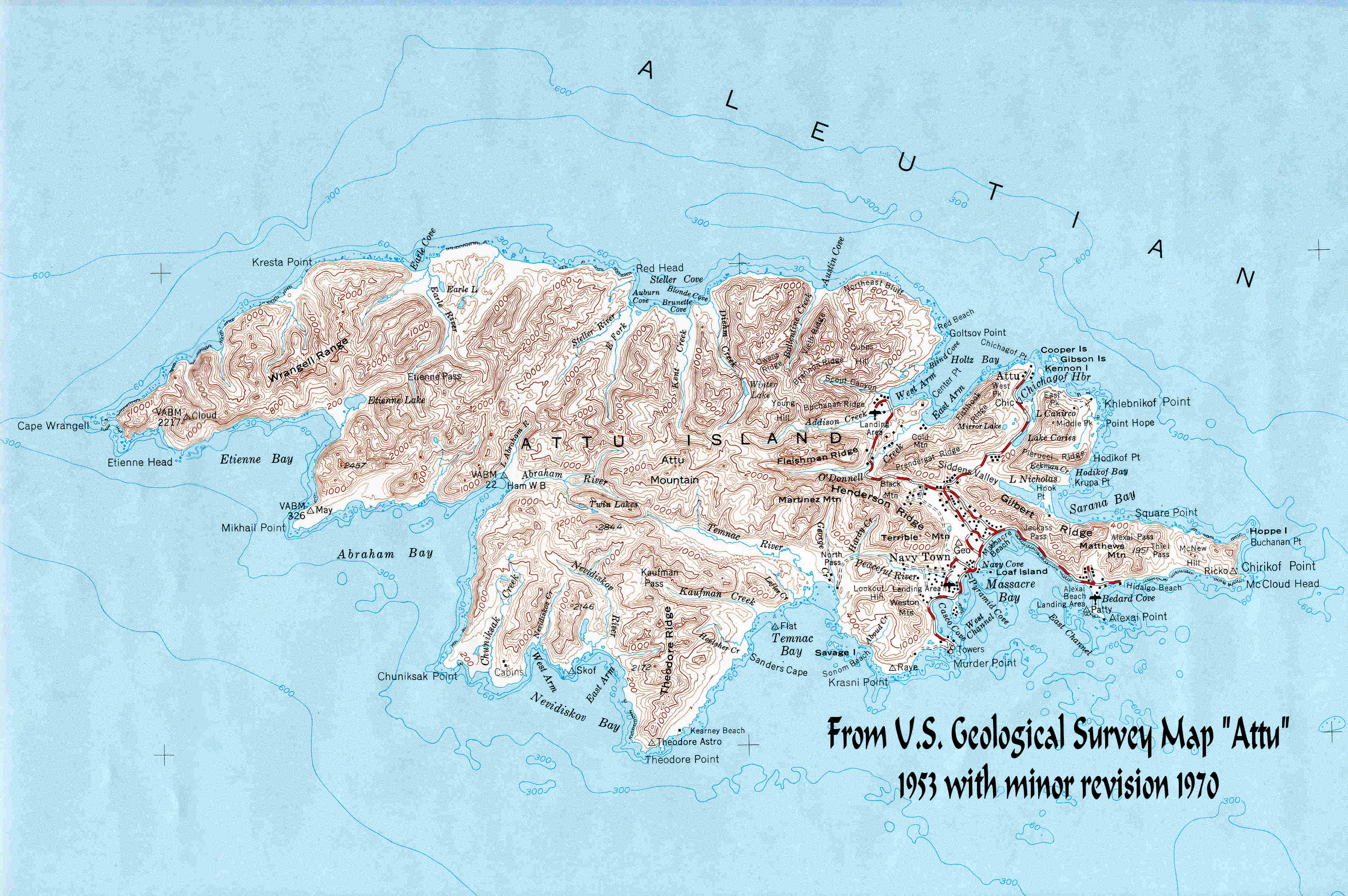
to accompany select photos we’ve included on our pages, and a second more detailed map of
Attu which we’ve obtained from the U. S. Geological Survey, dated 1953, including minor
revisions dated 1970, and another identifying the Attours Quarters location. The last shows
the landing areas for the Allied Invasion in May, 1942. This page provides quick access to
these maps. Click on the access icon for the 1st two maps and they will appear in a separate
(new) browser window.
The Grid Map: File size: 600 x 400 pixels, 65.2 kB. Access Icon: The USGS Map: File size: 3,680 x 2,447 pixels, 778 kB. Access Icon: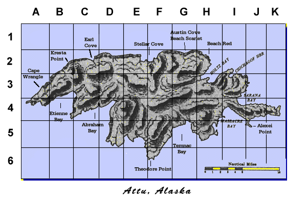
Specific
to
Internet
Explorer
Browser
(Others
may
emulate
this
functionality
as
well):
By
opening
this
map
in
a
new
browser
window
you
will
see
a
version
of
the
map
sized
to
fit
your
browser
window.
By
moving
your
cursor
over
the
displayed
map
you
should
see
a
magnifying
glass
icon
with
a
“plus”
sign
displayed.
Point
your
cursor
over
a
location
of
interest
and
left-
click
the
mouse…you
should
get
an
enlarged
version
displayed
of
that
area…determined
by
the
size
of
the
browser
window.
The
cursor
will
revert
to
a
“minus”
sign,
which
when
clicked
in
the
browser window will return the image to its original display size.
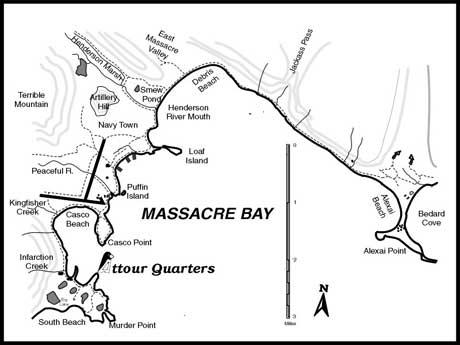
This
map
from
LORAN
History
depicting
various
highlighted
locations
around
Attu
Island,
including
the
rough
location
for
the
Attour
Quarters,
occupying
the
old LORAN-A buildings on Murder Point.
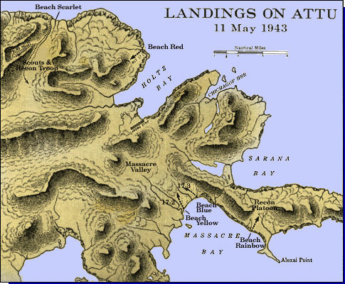
Map of U. S. Forces landing sites on Attu, 11 May 1943. (Source: Patrick Clancey)
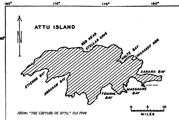
This map was extracted from the "Capture of Attu" book, published in 1944 by
the Infantry Journal, Inc. This book was one of many in the "Fighting Forces"
series, and was a first edition printed in October of 1944.