
AMCHITKA

aka Ostrove Amchitka

About
Amchitka, Aleutian Islands, AK
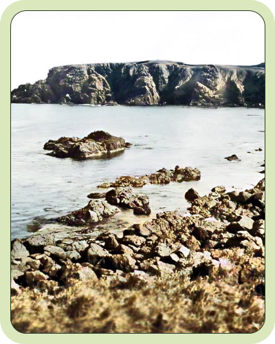
Amchitka is a volcanic, tectonically unstable island in the Rat Islands group of the Aleutian Islands in southwest Alaska. It is part of the Alaska Maritime National Wildlife Refuge. The island, with a land area of roughly 116 square miles (300 km2), is about 42 miles (68 km) long and 1 to 4 miles (1.6 to 6.4 km) wide.[2] The area has a maritime climate, with many storms, and mostly overcast skies. (wikipedia) Amchitka was populated for more than 2,500 years by the Aleut people, but has had no permanent population since 1832. The island has been part of the United States since the Alaska Purchase of 1867. During World War II, it was used as an airfield by US forces in the Aleutian Islands Campaign.Amchitka, WWII
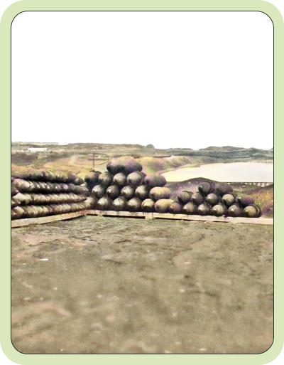
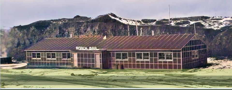
Amchitka was the site of some of the earliest American and Canadian victories during WWII, having been retaken from the Japanese in January of 1943. A large contingency of USAAF personnel and aircraft operated from Amchitka through the end of WWII. In June 1942, the Japanese occupied some of the western Aleutian islands, and hoped to occupy Amchitka. Eager to remove the Japanese, the Joint Chiefs of Staff agreed to move quickly to regain the territory. American planners decided to build a series of airfields to the west of Umnak, from which bombers could attack the invading forces. The U.S. Army established bases at Adak and 13 other locations. At the War Department's suggestion, an initial reconnaissance of Amchitka was carried out in September 1942, finding that it would be difficult to build an airstrip on the island. Nevertheless, planners decided on December 13 that the airfield "had to be built" to prevent the Japanese from doing the same. A further reconnaissance mission visited Amchitka from 17 to 19 December, and reported that a fighter strip could be built in two to three weeks, and a main airfield in three to four months. The plan was approved and began in 1942. American forces made an unopposed landing on Amchitka on January 12, 1943. Despite facing difficult weather conditions and bombing from the Japanese, the airfield was usable by February 16. The Alaska Command was now 50 mi away from their target, Kiska. The military eventually built numerous buildings, roads, and a total of three airstrips on the island, one of which would later be rebuilt and used by the Atomic Energy Commission in the late 1960s. 38 At its peak, the occupancy of Amchitka reached 15,000 troops. (Wikipedia)Amchitka, Nuclear Test Site
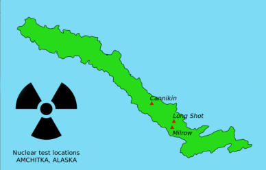
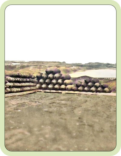
The U. S. Atomic Energy Commission created a nuclear testing facility on Amchitka in the early 1960's. A total of three subterranean nuclear test explosions were conducted on Amchitka during the 1960's and 1970's. The first detonation was of an 80 kiloton bomb known as "Long Shot" some 2,359 below the surface on the 29th of October, 1965. The second was "Milrow," a one megaton device, exploded on the 2nd of October, 1969, 4,000 feet below the surface of the island. The third device, "Cannikin," weighing in at 5 megatons, was detonated 6000 feet below ground level on the 6th of November, 1971. Cannikin was the largest underground nuclear explosion in U.S. history. The AEC withdrew from the island in 1973, though scientists continue to visit the island for monitoring purposes. In 2001, the DoE returned to the site to remove environmental contamination. Drilling mud pits were stabilized by mixing with clean soil, covering with a polyester membrane, topped with soil and re-seeded. (Wikipedia) The Amchitka testing facility was closed in 1994, accompanied by an on- going U.S. Government effort at cleaning up the residual radioactive, chemical, and other hazardous waste left on the island. While there is an airstrip on Amchitka, as of this writing it is currently restricted to U. S. Government flights only.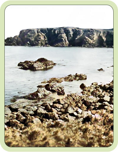
© hlswilliwaw.com


Amchitka

aka Ostrove Amchitka
About
Amchitka, Aleutian Islands, AK
Amchitka is a volcanic, tectonically unstable island in the Rat Islands group of the Aleutian Islands in southwest Alaska. It is part of the Alaska Maritime National Wildlife Refuge. The island, with a land area of roughly 116 square miles (300 km2), is about 42 miles (68 km) long and 1 to 4 miles (1.6 to 6.4 km) wide.[2] The area has a maritime climate, with many storms, and mostly overcast skies. (wikipedia) Amchitka was populated for more than 2,500 years by the Aleut people, but has had no permanent population since 1832. The island has been part of the United States since the Alaska Purchase of 1867. During World War II, it was used as an airfield by US forces in the Aleutian Islands Campaign.Amchitka, WWII
Amchitka was the site of some of the earliest American and Canadian victories during WWII, having been retaken from the Japanese in January of 1943. A large contingency of USAAF personnel and aircraft operated from Amchitka through the end of WWII. In June 1942, the Japanese occupied some of the western Aleutian islands, and hoped to occupy Amchitka. Eager to remove the Japanese, the Joint Chiefs of Staff agreed to move quickly to regain the territory. American planners decided to build a series of airfields to the west of Umnak, from which bombers could attack the invading forces. The U.S. Army established bases at Adak and 13 other locations. At the War Department's suggestion, an initial reconnaissance of Amchitka was carried out in September 1942, finding that it would be difficult to build an airstrip on the island. Nevertheless, planners decided on December 13 that the airfield "had to be built" to prevent the Japanese from doing the same. A further reconnaissance mission visited Amchitka from 17 to 19 December, and reported that a fighter strip could be built in two to three weeks, and a main airfield in three to four months. The plan was approved and began in 1942. American forces made an unopposed landing on Amchitka on January 12, 1943. Despite facing difficult weather conditions and bombing from the Japanese, the airfield was usable by February 16. The Alaska Command was now 50 mi away from their target, Kiska. The military eventually built numerous buildings, roads, and a total of three airstrips on the island, one of which would later be rebuilt and used by the Atomic Energy Commission in the late 1960s. 38 At its peak, the occupancy of Amchitka reached 15,000 troops. (Wikipedia)Amchitka, Nuclear Test Site
The U. S. Atomic Energy Commission created a nuclear testing facility on Amchitka in the early 1960's. A total of three subterranean nuclear test explosions were conducted on Amchitka during the 1960's and 1970's. The first detonation was of an 80 kiloton bomb known as "Long Shot" some 2,359 below the surface on the 29th of October, 1965. The second was "Milrow," a one megaton device, exploded on the 2nd of October, 1969, 4,000 feet below the surface of the island. The third device, "Cannikin," weighing in at 5 megatons, was detonated 6000 feet below ground level on the 6th of November, 1971. Cannikin was the largest underground nuclear explosion in U.S. history. The AEC withdrew from the island in 1973, though scientists continue to visit the island for monitoring purposes. In 2001, the DoE returned to the site to remove environmental contamination. Drilling mud pits were stabilized by mixing with clean soil, covering with a polyester membrane, topped with soil and re-seeded. (Wikipedia) The Amchitka testing facility was closed in 1994, accompanied by an on-going U.S. Government effort at cleaning up the residual radioactive, chemical, and other hazardous waste left on the island. While there is an airstrip on Amchitka, as of this writing it is currently restricted to U. S. Government flights only.