
KISKA

Aleutian Islands, AK

About
Kiska and WWII
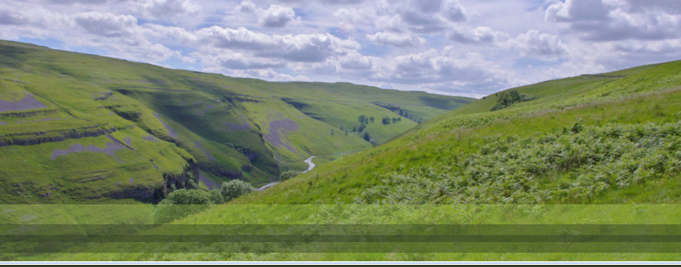
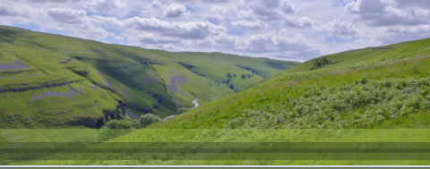
Kiska is an island in the Rat Islands group of the Aleutian Islands of Alaska, and is volcanic in its origins. It is uniformly rocky and barren and supports scant vegetation. There are no trees on the island. The lowlands are covered with a spongy tundra or muskeg as much as three feet thick, making walking very difficult. Below the tundra is volcanic ash, finely ground and water soaked to the consistency of slime. In many places water is trapped in ponds under the tundra. A man on foot may readily break through the tundra, sinking in watery mud up to his knees. Kiska is about 22 miles (35 km) long and varies in width from 1.5 to 6 miles (2.4 to 9.7 km). It is part of Aleutian Islands Wilderness and as such, special permissions are required to visit it. The island has no permanent population. The Aleutians, being unsuitable for agriculture, lacking in mineral resources, and with little possibility of commercial exploitation, received only slight attention after their acquisition from Russia in 1867. A chart of the coast lines were prepared by the United States Coast and Geodetic Survey office. The Aleutian island's shorelines are jagged with submerged rock formations rendering navigation hazardous. Aleutian weather becomes progressively worse as you travel from the easternmost islands to the west. The weather is typified by cold, damp fog, often accompanied by snow or icy rain. The winds often reach velocities of more than 100 miles an hour. There are many days during the year where working outside is impossible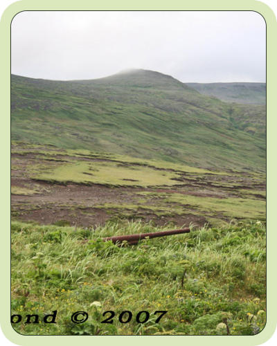
This website features the photos and stories of members of
the U. S. Navy stationed on Kiska and the Japanese military
as they captured and occupied Kiska, Aleutian Islands,
Alaska


KISKA

Aleutian Islands, AK
About
Kiska and WWII
Kiska is an island in the Rat Islands group of the Aleutian Islands of Alaska, and is volcanic in its origins. It is uniformly rocky and barren and supports scant vegetation. There are no trees on the island. The lowlands are covered with a spongy tundra or muskeg as much as three feet thick, making walking very difficult. Below the tundra is volcanic ash, finely ground and water soaked to the consistency of slime. In many places water is trapped in ponds under the tundra. A man on foot may readily break through the tundra, sinking in watery mud up to his knees. Kiska is about 22 miles (35 km) long and varies in width from 1.5 to 6 miles (2.4 to 9.7 km). It is part of Aleutian Islands Wilderness and as such, special permissions are required to visit it. The island has no permanent population. The Aleutians, being unsuitable for agriculture, lacking in mineral resources, and with little possibility of commercial exploitation, received only slight attention after their acquisition from Russia in 1867. A chart of the coast lines were prepared by the United States Coast and Geodetic Survey office. The Aleutian island's shorelines are jagged with submerged rock formations rendering navigation hazardous. Aleutian weather becomes progressively worse as you travel from the easternmost islands to the west. The weather is typified by cold, damp fog, often accompanied by snow or icy rain. The winds often reach velocities of more than 100 miles an hour. There are many days during the year where working outside is impossible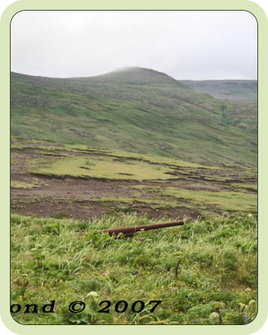
This website features the photos and stories of members
of the U. S. Navy stationed on Kiska and the Japanese
military as they captured and occupied Kiska, Aleutian
Islands, Alaska