


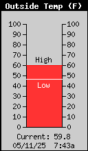


Temperature
87.9 °F
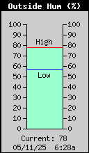
Humidity
40 %
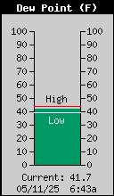
Dewpoint
60.6 °F
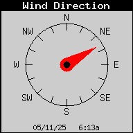
Wind
ENE at 2.0 mph

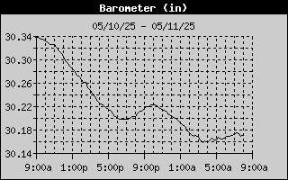
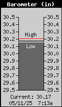
Barometer
30.068 in

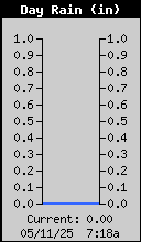
Today's Rain
0.00 in
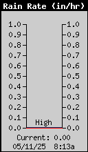
Rain Rate
0.00 in/hr
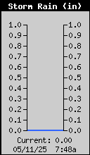
Storm Total
0.00 in
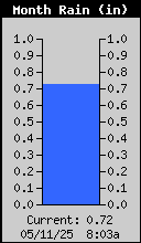
Monthly Rain
0.21 in
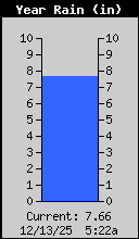
Yearly Rain
4.40 in
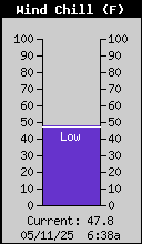
Wind Chill
87.9 °F
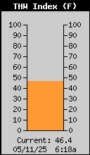
THW Index
88.0 °F
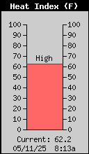
Heat Index
88.0 °F
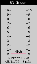
UV
0.9 index
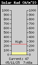
Solar Radiation
121 W/m2


High Temperature
88.1 °F at 12:40p
Low Temperature
75.4 °F at 6:08a
& Falling Slowly
High Humidity
56 % at 5:49a
Low Humidity
36 % at 2:08a
High Dewpoint
65.0 °F at 12:32p
Low Dewpoint
54.0 °F at 2:08a
High Barometer
30.119 in at 8:30a
Low Barometer
30.039 in at 2:12a


High Rain Rate
0.00 in at ----
Low Wind Chill
75.0 °F at 6:08a
High Heat Index
90.0 °F at 12:13p
High UV
1.8 index at 12:02p


High Solar Radiation
214 W/m2 at 11:59a
Weather Forecast: Increasing clouds with little temperature change. Precipitation possible within 24 to 48 hours

Moon Phase: Full Moon
Sunrise: 5:56a Sunset: 8:17p
Station Latitude: 39° 39' 44" N
Station Longitude: 105° 05' 36" W
Station Elevation: 5408 ft


This Month
Last Month
This Year

NOAA LINKS
GOES East Hurricane Sector GOES Image Search NWS Satellite ImageryMISCELLANEOUS
Weather Terms/Definitions Wunderground WX Lakewood Davis Weather Report Davis WeatherLink Site CWOP for CW6981 METAR METAR Map Historical Data Station Log Synopsis Aurora, CO Weather Denver/Boulder CO Radar Map Colorado State Roads & Cams Colorado Avalanche Info Center


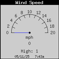
10-Minute Avg Wind Speed
1.0 mph


High Wind Speed
7.0 mph at 11:24a

Current as of: 07/27/26, 2:45p
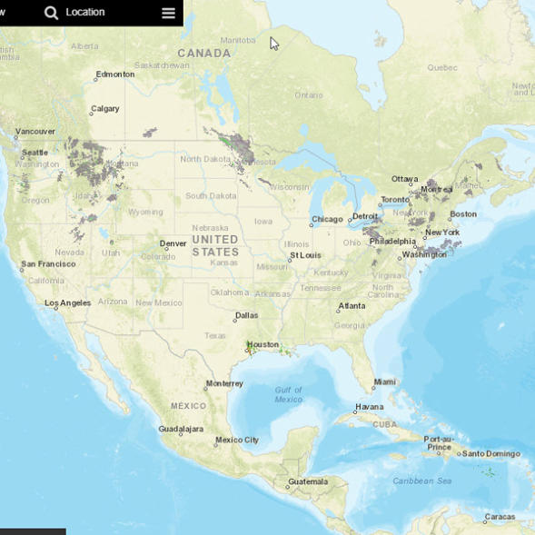

NWS RADAR
Click on map to view NWS’s new radar presentation. While the default map shows Denver area, you can select any other area of your choice!


Temperature
87.9 °F
Humidity
40 %
Dewpoint
60.6 °F
Wind
ENE at 2.0 mph

Barometer
30.068 in

Today's Rain
0.00 in
Rain Rate
0.00 in/hr
Storm Total
0.00 in
Monthly Rain
0.21 in
Yearly Rain
4.40 in
Wind Chill
87.9 °F
THW Index
88.0 °F
Heat Index
88.0 °F
UV
0.9 index
Solar Radiation
121 W/m2


High Temperature
88.1 °F at 12:40p
Low Temperature
75.4 °F at 6:08a
& Falling Slowly
High Humidity
56 % at 5:49a
Low Humidity
36 % at 2:08a
High Dewpoint
65.0 °F at 12:32p
Low Dewpoint
54.0 °F at 2:08a
High Barometer
30.119 in at 8:30a
Low Barometer
30.039 in at 2:12a


High Rain Rate
0.00 in at ----
Low Wind Chill
75.0 °F at 6:08a
High Heat Index
90.0 °F at 12:13p
High UV
1.8 index at 12:02p


High Solar Radiation
214 W/m2 at 11:59a
2:45p
07/27/26
Weather Forecast: Increasing clouds with little temperature change. Precipitation possible within 24 to 48 hours

Moon Phase: Full Moon
Sunrise: 5:56a Sunset: 8:17p
Station Latitude: 39° 39' 44" N
Station Longitude: 105° 05' 36" W
Station Elevation: 5408 ft


This Month
Last Month
This Year

NOAA LINKS
GOES East Hurricane Sector GOES Image Search NWS Satellite ImageryMISCELLANEOUS
Weather Terms/Definitions Wunderground WX Lakewood Davis Weather Report Davis WeatherLink Site CWOP for CW6981 METAR METAR Map Historical Data Station Log Synopsis Aurora, CO Weather Denver/Boulder CO Radar Map Colorado State Roads & Cams Colorado Avalanche Info Center


High Wind Speed
7.0 mph at 11:24a
10-Minute Avg Wind Speed
1.0 mph


NWS RADAR
Click on map to view NWS’s new radar presentation. While the default map shows Denver area, you can select any other area of your choice!