


Last Updated: 11/23/2016 08:52
ATTU, POST-WWII PHOTOS, PAGE 2

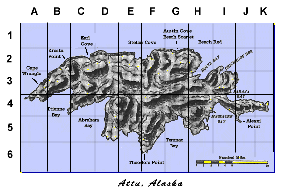
Click on the compass icon below to bring up the Attu, AK. coordinates map in a separate window. This map will help to locate
where on the Island the photos are taken. We’ll add the coordinates to the descriptions for each photo as they are supplied.
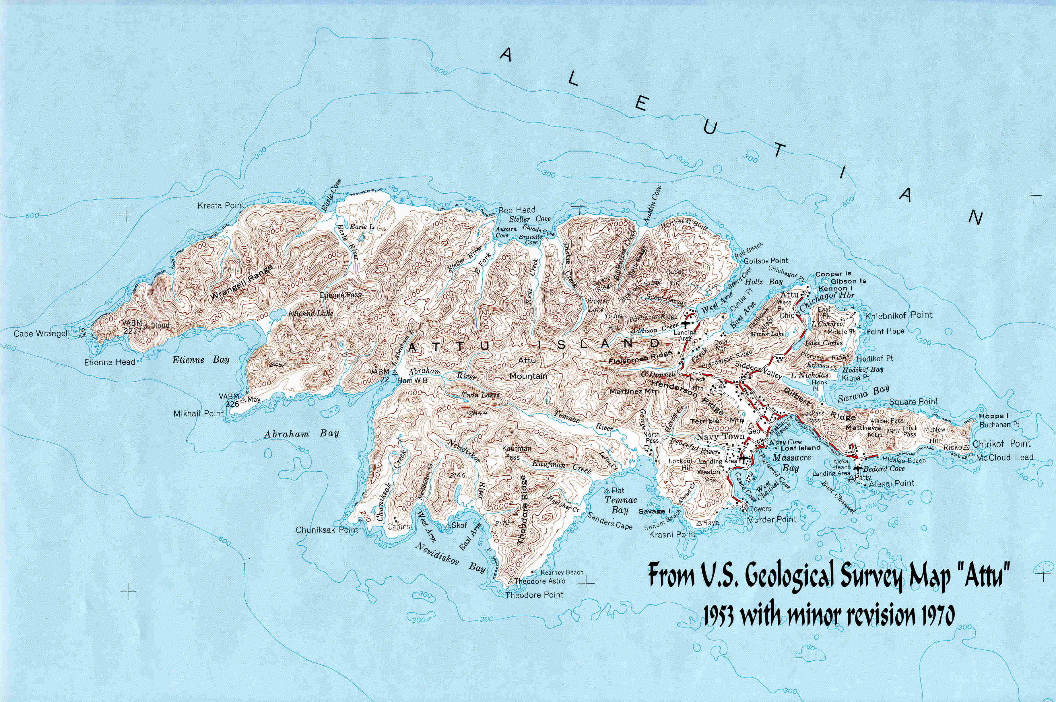
Click on the pin/map for an enlarged U.S.G.S. Survey Map of Attu in a separate window.


![The Old Piers by Navy Town. Attu, 1993. Is that the "fog monster" in the background? [Photo by Pete Wolfe, provided by R. Thibault]](index_htm_files/224400.jpg)
#1. The Old Piers by Navy Town. Attu, 1993. Is that the "fog
monster" in the background? (Photo by Pete Wolfe,
provided by R. Thibault)
![Coco, the Attu Coast Guard Station mascot. January, 1995. [Photo by Jim Flynn, provided by R. Thibault]](index_htm_files/224401.jpg)
#2. Coco, the Attu Coast Guard Station mascot. January,
1995. (Photo by Jim Flynn, provided by R. Thibault)
#3. A 1995 black and white panoramic view of Attu. (Photo
by Jim Flynn, provided by R. Thibault)
![A black and white panoramic view from Attu. 1995 [Photo by Jim Flynn, provided by R. Thibault]](index_htm_files/267155.jpg)
![This stitched composite of a view looking towards Massacre Bay, probably from Artillery Hill. [provided by Rene Thibault]](index_htm_files/267156.jpg)
#4. This stitched composite of a view looking towards
Massacre Bay, probably from Artillery Hill. provided by
Rene Thibault)
![This photo was taken on Attu in the May/June 1995 time frame. It is showing the front of the Coast Guard's Loran Station. [Photo by Jim Flynn, provided by R. Thibault, Coord H5]](index_htm_files/224404.jpg)
#5. This photo was taken on Attu in the May/June 1995 time
frame. It is showing the front of the Coast Guard's LORAN
Station. (Photo by Jim Flynn, provided by R. Thibault,
Coord H5)
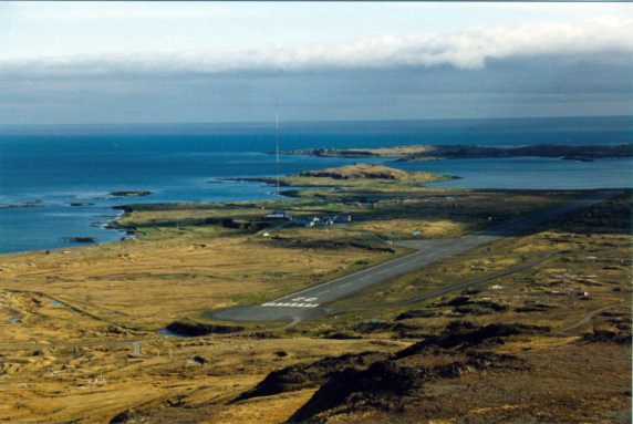
#6. Coast Guard Area and Air Strip, Attu, AK. May-June
1995. (Photo by Jim Flynn, provided by R. Thibault)
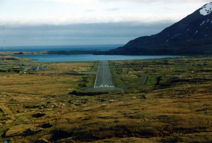
#7. Attu's Coast Guard Station and Runway. May-June 1995.
(Photo by Jim Flynn, provided by R. Thibault)
![Attu's Massacre Valley and the Jarmin Pass, 1995. [Photo Jim Flynn, provided by R. Thibault]](index_htm_files/224407.jpg)
#8. Attu's Massacre Valley and the Jarmin Pass, 1995.
(Photo Jim Flynn, provided by R. Thibault)
#9. A May-June 1995 panoramic view of what was the
Marine Area in 1945, looking South towards Massacre Bay
in the direction of Casco or Temnac Bay. Click HERE to
view enlarged area, and to compare 1946 with 1995 image.
(Photo by Jim Flynn, provided by R. thibault)
#10. A 1995 panoramic view of what was the Marine Area in
1945, looking South towards Massacre Bay in the direction
of Casco or Temnac Bay. Near the upper right of the photo
you can see the remains of the guard shack seen in photo
#1 of the Attu WWII Photo Pg 4 page. (Photo by Jim Flynn,
mark-ups and photo provided by Rene "Frenchy" Thibault)
![1995 Attu; View of WWII-era Marine Area, looking south towards Massacre Bay in direction of Casco or Temnac Bay. [Jim Flynn]](index_htm_files/224409.jpg)