Photo By Kare Lohse
ATTU, ALEUTIAN ISLANDS, ALASKA
“From Here You Can See Tomorrow”


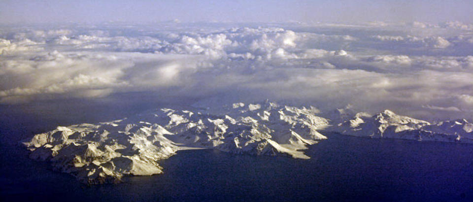
Attu, the westernmost piece of American territory and largest island in the Aleutian
Islands’ Near Islands grouping, is nearly 1,100 miles from the Alaskan mainland and
750 miles northeast of the northernmost of Russia’s Kurile Islands, and 4,800 miles
from Washington DC. Attu is about 20 by 35 miles in size, the highest elevation being
2,946 feet (Attu Mountain), and until 1 August 2010 was the home of a small number
of U. S. Coastguard personnel operating a LORAN station. The western international
date line on average lies at the 180 degree line of longitude in the middle of the Pacific
Ocean. Attu's longitude is a bit more than 173 degrees, very close to the date line. The
date line was drawn slightly curved westward around Attu. Some rough calculations show Attu to be around
453km (or 281 miles) from the dateline would it exist at the 180 degree longitude point. Therefore, if you are
standing on Attu and look to the west, you can in your mind at least see "tomorrow."
Attu was occupied on June 6th, 1942 by the Japanese, and was the site of some of the bloodiest fighting during
WWII (second only to Iwo Jima) commencing on "D-Day," 11 May 1943. See the "Brief History" of the war in the
Aleutians by clicking on the "WWII" menu selection in the top menu. The battle of Attu ended 30 May 1943 with the
Japanese forces on the island having been annihilated, with only 28 prisoners captured by the Allied Forces.
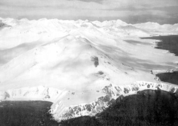
The need for a LORAN station was deemed necessary on the southern most tip of Attu. The equipment to build the
station came out of Holtz Bay and was ferried on barges and landing craft to Baxter Cove located about one mile
east of the station. Bulldozers were used to cut a road from Baxter Cove to Theodore Point (see map) over which
the equipment was hauled. The construction began about November 1943 by a USCG Construction Detachment.
The main building consisted of five Quonset huts shaped like an "H" with connecting passageways. The
LORAN/Radio Shack was one Quonset hut located on the point next to a 400 ft cliff which dropped down to the
Pacific Ocean. The original commanding officer was a Lt. Jg Doster and one of the original crew members is Bob
Yeaton of MA. Several crew members who served during the period 1943 to 1947 held their first reunion in 1996
and a second reunion in September 1998. A normal crew consisted of approximately 20 men and the tour of duty
was one year more or less. There are seventeen known members who make up the original survivors of the most
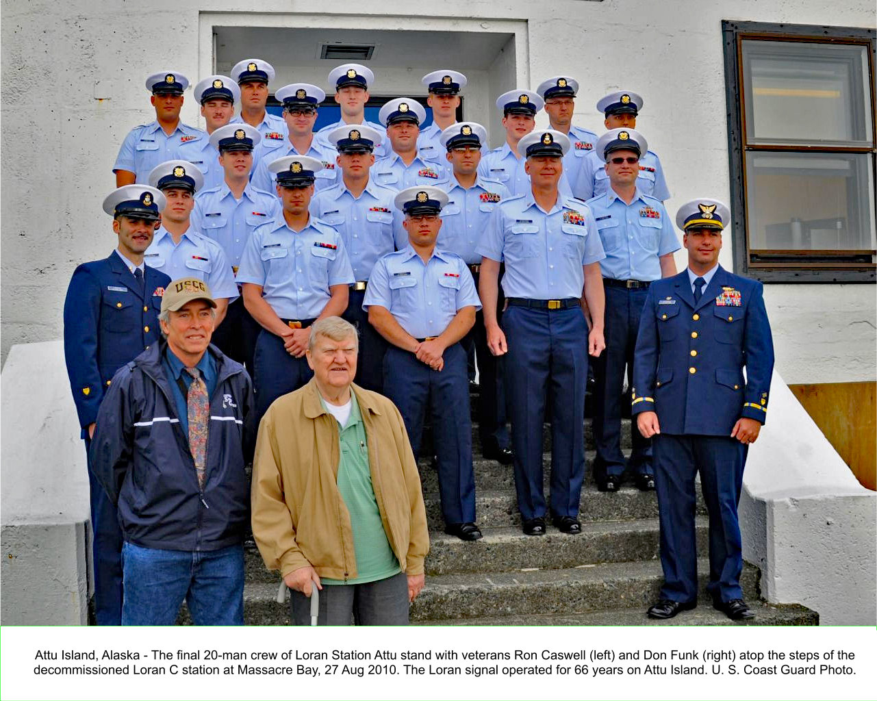
isolated station in the world. In 1960 the station was moved to Casco Cove, near the former Navy Base at Massacre
Bay. Later it was changed from a LORAN "A" to LORAN "C" and moved into a modern building at Massacre Bay. The
station was in operation and manned by a crew of 20 up until the 27th of August, 2010 when it was closed as a
result of government cost-cutting measures, and in recognition of the fact LORAN was now old technology with
GPS having taken its place. This was the only station on the island and the only human inhabitants. A book entitled
"Lonely in the Aleutians" by Dick Griessel was recently published giving detailed information about US Coast Guard
Unit 62, Theodore Point. Dick served there from 1945-1946. The book was a limited edition and presently not
available to the public. (The point of contact for men who served on Theodore Point during 1943 to 1947 is: Ardon W
"Smitty" Smith, 250 Stratford Way, Fayetteville, GA 30214 Phone 770-461-8834).
A radio program broadcast by KUCB at the time of Attu's closing can be heard at this link:
http://archive.kucb.org/news/article/alaska-coast-guard-says-goodbye-to-its-last-LORAN-station/The weather on Attu is typical of Aleutian weather in general...cloudy, rainy, foggy, with occasional very high
winds. The weather becomes progressively worse as you travel from the easternmost islands to the west. On Attu,
five or six days a week are likely to be rainy, with hardly more than eight or ten clear days a year. The rest of the
time, even if rain is not falling, fog of varying density is the rule rather than the exception. The average rainfall is
around 40 to 50 inches throughout the islands, with the heaviest rains experienced during fall and early winter.
Attu war stories can be found on the "Attu War Stories" page. Photos of Attu during WWII can be found by selecting
the "Attu WWII" menu selection, while photos of Attu after the war can be found by selecting the "Post WWII"
menu selection.
Links to other Attu sites are located on the "Attu Links" page. If you find some that I don't have, I'd sure appreciate
it if you'd email them to me, as well as to let me know when existing links are found to be broken!
For additional stories of Attu from the WWII time frame, go to the Shemya Homepage and select "Shemya
Mailbag." There are numerous stories at the Shemya Mailbag site, courtesy of Dan Lange, written by folks that had
been stationed on Attu (as well as Shemya) during War II.
George L. Smith


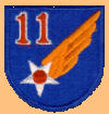
UNIT PATCHES AND EMBLEMS OF ATTU


Online Since 13 Sep 1998


Page Last Updated: 05/04/2017 13:22
Site Last Updated: 06/05/2026 14:01


Version #: Attu-Ops-20260605-1015